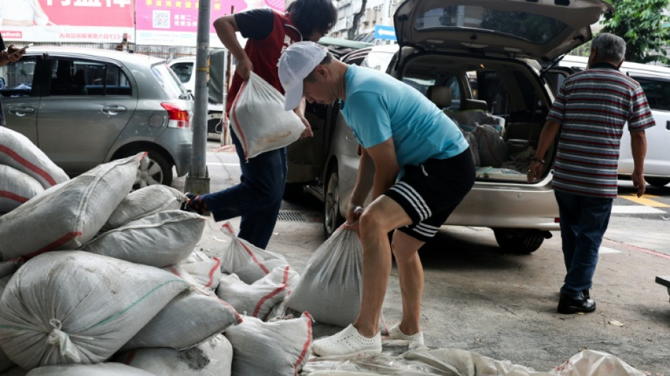
Taiwan warns of 'destructive' winds as typhoon nears / Photo: © AFP

Taiwan's weather forecaster warned on Thursday of "destructive" winds as the biggest typhoon in years swept towards the island after pounding US Pacific territories.
Typhoon Bavi is whipping up waves several metres (yards) high and is expected to batter the island's north on Friday and Saturday before smashing into China, already hit by deadly storms this week.
"Relatively destructive" winds are likely to "cause damage" in Taiwan, including in the port city of Keelung and the coastal county of Yilan, Central Weather Administration (CWA) forecaster Jason Cheng told AFP.
After hitting Guam and the Northern Marianas on Monday as a super typhoon, Bavi was downgraded to a typhoon as it moved across the Pacific Ocean.
The typhoon was packing maximum sustained wind speeds of 184 kilometres (114 miles) per hour and gusts of around 227 kilometres per hour on Thursday, the CWA said.
With a gale-force wind radius of 380 kilometres, Bavi is the largest typhoon to hit Taiwan since 1995 when methods for measuring the size of storms changed, Cheng said.
He said that the greatest impact is expected in northern areas including Yilan and Keelung, adding that "even areas away from the typhoon's centre could be affected and should remain vigilant."
Most ferry routes to outer islands have been suspended.
Taiwan's coast guard warned people to stay away from the coast, with four-to-six-metre (13-20-feet) waves already recorded in waters off southern Taitung county and Orchid Island.
At a port in Keelung, fishing boat owner Tung Wan-tsai said he was "a bit worried" about the approaching typhoon.
"It's too big," Tung, 75, told AFP.
"Even if it doesn't make direct landfall, its radius of gale-force winds is simply too massive. Especially with this trajectory, it is bound to become a 'northwest typhoon', which is the worst-case scenario."
- 'Too dangerous' -
Fishing boat captain Chang Ting-hsin, 53, said he returned to port on Wednesday night, weeks earlier than he had planned, due to the typhoon.
"You absolutely have to come back," Chang said as he unloaded his catch.
"If you don't return, it's just too dangerous. If you're even a day late getting back, and you're not clear on the typhoon's movement, if it moves fast, you won't even have time to run."
On Japan's remote southwestern islands, schools and supermarkets will close on Friday.
Pineapple farmers harvested their fruit early and fishermen secured their boats ahead of Bavi, Japanese media said. Dozens of flights have been cancelled.
After sweeping past Taiwan, Bavi is expected to make landfall in eastern China over the weekend.
Extreme weather has already wreaked havoc on southern and central China this week, with storms leaving 17 dead and causing dozens of rivers to overflow and a reservoir dam to burst.
Oceans experienced their hottest June on record and could set fresh highs in the months ahead, the European Union's Copernicus Marine Service said last week.
Warmer oceans help tropical storms to intensify and add more moisture, which can fall as heavy rain.
Adding to the mix is the return this year of El Nino, a natural climate phenomenon that warms Pacific surface temperatures and typically occurs every two to seven years.
burs-joy/amj/ami
P.Navarro--TFWP